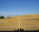
My partner and I “vacation” by touring the west on our motorcycle.
Our trips generally cover 9 days/8 nights and 6-7 states or provinces and are intensively planned.We depart with an itinerary that covers daily mileage, motel reservations, highway construction reports, and where we’ll gas up (only relevant if we’re traveling through a remote stretch that could suck our 3.5 gallon tank dry.)
The trip planning is my job and I love it. When I was a kid I used to plan imaginary trips for my family and our trailer using a road atlas and a KOA or Good Sam directory — so clearly planning is in my DNA. The tools I use now are far more sophisticated thanks to the internets, but the process can still easily take 8 – 12 hours spread out over several days or weeks.
My planning begins with paper maps, Google and/or Yahoo maps, Kayak.com, TripAdvisor.com and the websites of the chain motels. Google and Yahoo have made great strides in the past year, incorporating features that link together a string of routes. What they both still seem to be lacking is an easy way to save these routes. Kayak is awesome for providing a list of available hotels with real time data about room availability and price. TripAdvisor is invaluable due to it’s user reviews; many times I’ve chosen say the local Comfort Inn over the local Best Western because of customers (like myself) taking the time to encapsulate their experience.
I’ll have an idea of one or two places we want to visit, but the trajectory of the trip is wide open at the start. Our main variable is seat time, which varies dramatically depending on road type. We can cover 450 miles on the freeway or 300 miles on smaller highways in the same 7 or 8 hour period. The second variable is a destination with a motel that provides high speed internet access, a flexible cancellation policy and a paved parking lot. The interplay between these two variables is the creative element of trip planning.
The first iteration of the trip takes 4-6 hours. There are only so many ways to leave Seattle, but once you get a day or two away the 360 degree arc opens up endless choices. Sometimes I’ll have two possible legs going simultaniously, waiting to see which will have the more interesting resolution as we begin to head towards home.
Once the trip circle is complete, I’ll sit down with my partner to get her thoughts. She invariably brings up gas and construction questions that I haven’t thought about in the excitement of planning. These are not sexy questions, but of course crucial to real time enjoyment once we’re on the road. Gas is usually pretty easy to ID; I’ll type in a location + gas into google and get a pretty clear answer either through a business listing or a recreational site.
Construction is trickier due to the variety of approaches state highway departments use for imparting this information on their websites. Montana for instance, provides one long scrolling page with highway numbers in one column and a description involving mileposts or towns in another. This is a cumbersome format to scan and interpret — especially if you aren’t from Montana. Wyoming on the other hand, starts with a map that drills into regions where helpful icons display construction spots. Even with Wyoming’s easier UI, getting a clear description of the actual road conditions can be impossible without a phone call. I dream of the day where a cadre motorcycle riders will snap photos or real time construction conditions and geo tag them to a common flickr map along with a quick statement.
The truth about trip planning though, is that one key element can never be planned in advance: Weather.
For all my intricate planning, we have so far only successfully completed 1 of 4 itineraries. (The successful trip was the first trip of course, leading us to believe it could always be so easy!) So far all my hours spent crafting the perfect trip, usually the moment arrives where I’m in holed up in the hotel room re-routing the remainder of the trip to avoid wind or rainstorms (although we seem to get caught in both anyways!) This is why broadband is essential for our travel. Wifi is getting easier to find on the road (even McDonalds offers it) and is essential for making daily and sometimes hourly choices about our next move.


billo said,
June 2, 2007 at 5:59 pm
In a pinch, on the road, you could try kayak mobile search. Point your phone at http://www.kayak.com/moby/ and you’ll get a very phone-optimized UI for finding a place to sleep *tonight*.
best regards,
bill, chief architect, kayak.com
Designing Presence: The many problems with Garmin’s GPS ecosystem « Designing Presence said,
July 2, 2007 at 4:00 pm
[…] “MapSource” software. It is some of the most frustrating software I have ever used. My initial trip planning process is done online using Google or Yahoo maps and various web sites to determine travel […]